When you think of Africa, do you think of 85-kilometer canyons in Namibia, glaciers on the equator, or herds of grass-eating monkeys grazing an Ethiopian plateau at 3,500 meters? What about hikes passing towering granite spires in Madagascar?
Standing on the roof of Africa is a hell of a moment. Personally, I loved every minute of the experience but it’s hard to get past just how overdeveloped Kilimanjaro has become.
The good news is that there are so many more amazing summits and multi-day hikes in Africa, far removed from the Kili crowds. In this guide, we’ll reveal what we believe are the regions and mountains offering the best treks in Africa.
Drakensberg Mountains, South Africa – Mnweni Circuit
- Distance: 40 km
- Days: 3
- Logistics: Permits through the Mnweni Cultural Centre, which can be organized on arrival, tent and cave camping, best April-May or September-October
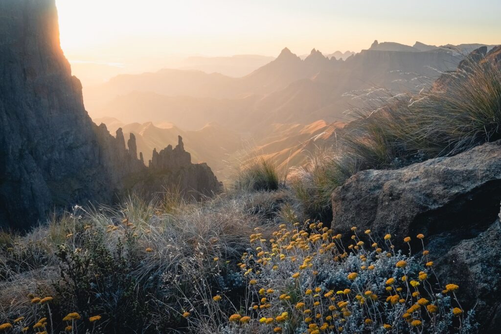
The Drakensberg is the highest range in eastern South Africa. This isn’t a conventional peak, but the torn edge of a high plateau, spanning over 1,000 kilometers and forming a natural border between South Africa and the independent kingdom of Lesotho.
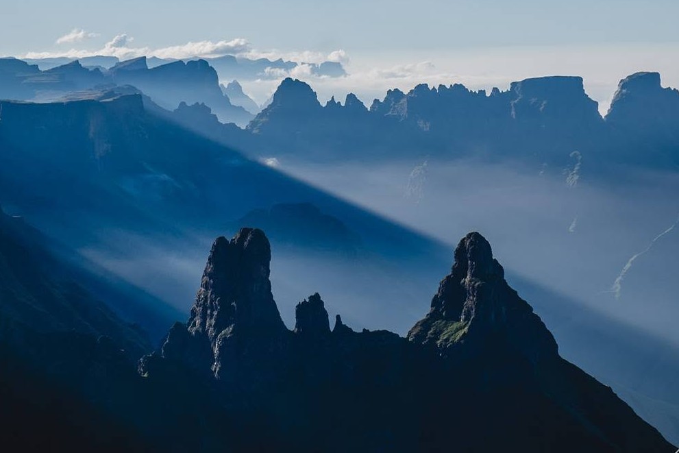
The terrain here is truly unique. The escarpment rises suddenly like a shield wall from the Zulu foothills, ending abruptly like a plateau, and is punctuated by almost Dolomite-like spires. At the top of the escarpment, you can dangle them off the edge with nothing below for hundreds of meters. When the clouds roll in below, it truly feels like you’re on an island in the sky.
The Drakensberg’s many ridgelines and their spines have inspired its many titles: the Boers called them the “Dragon Mountains”, resembling the backs of the mythical creatures, while the Zulus called them uKhahlamba or “The Wall of Spears”.
The Drakensberg is one of the most beautiful hiking regions in Africa and is split into three sections. The Northern Berg has the Amphitheatre and Tugela Falls (currently contested as the tallest waterfall in the world), the Central Berg has the Cathedral Peak valleys and is known for incredible San rock art, and the Southern Berg has Sani Pass and gentler green foothill walking. You can connect them altogether into a single epic hike called the Drakensberg Grand Traverse.
Many of the hiking routes in the Drakensberg Mountains involve climbing a high pass to the plateau. This is Lesotho: open grassland at 3,000 meters where Basotho herders ride out wrapped in blankets, the only buildings are stone huts, and bearded vultures work the thermals along the escarpment edge. There are too many multi-day hiking routes to list in the Drakensberg, but Mnweni is a great start, though nearly all routes here are unmarked, so plan accordingly.
Rwenzori Mountains, Uganda – Weismann’s Peak

- Distance: 61.5 km
- Days: 6 trekking days
- Logistics: Mountain huts throughout, guide required, best June-August or December-February
Ptolemy put the Rwenzori Mountains on a map in 150 AD and called them the Mountains of the Moon, the snow-capped source of the Nile. There are permanent glaciers here, sitting almost exactly on the equator, and Margherita Peak towers high above the clouds at 5,109 meters – the third-highest point in Africa.
Hiking in the Rwenzori Mountains is significantly safer than it used to be. Climbing these mountains involves passing through five separate worlds. Montane forest, then bamboo, then a heather zone where tree heathers grow three meters tall, and every surface is upholstered in moss, then afroalpine ground covered in giant lobelias and prehistoric groundsel trees. Then finally, bare rock and ice on the peaks.
In our opinion, the Rwenzoris are one of the most underrated hiking regions in Africa, which is why we started running expeditions here. The true summit involves technical alpine climbing, but there are other excellent routes in the Rwenzori offering the full experience without requiring extensive alpine skills – including our favorite, Weismann’s Peak (4,620 m). T
Bonus: The region is also comparatively close to forests where you can do chimp and gorilla trekking.
Simien Mountains, Ethiopia – Escarpment Trek
- Distance: 50-60 km
- Days: 3-5
- Logistics: Register at Debark park HQ, an armed scout is mandatory, best October-November
The Simiens are what is left of a shield volcano that’s been eroding for 30 million years. Today, it’s a plateau torn into pinnacles and buttresses, with a northern escarpment running 35 kilometers and cliffs that drop 1,500 meters in a single fall. Ras Dashen, the highest point in Ethiopia, sits at 4,533 meters at the eastern end of the Simiens.
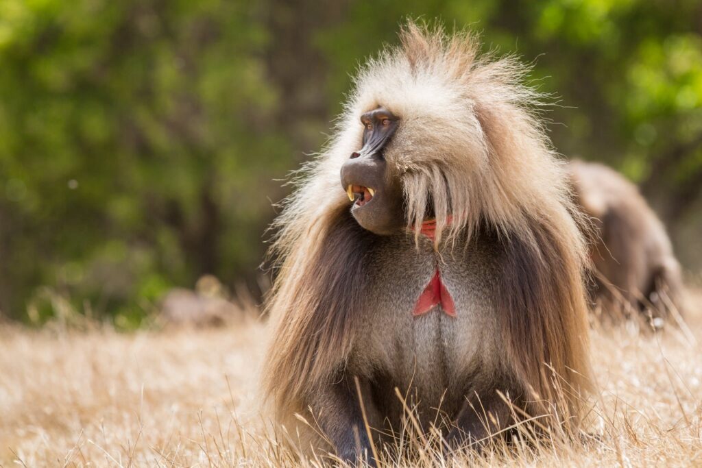
Up on the grasslands you’ll share the hiking trail with gelada baboons, the only primate on earth that lives on grass. They graze in herds of several hundred along the plateau edge and sleep on the cliff faces below it, and they’re relaxed enough around people that you can sit down and watch them. Walia ibex live here too. In fact, they’re found nowhere else on the planet. So does the Ethiopian wolf, the rarest canid in the world.
Treks run from three days along the escarpment to ten if you want to summit Ras Dashen, which involves spending most nights above 3,000 meters.
Fish River Canyon, Namibia
- Distance: 86 km
- Days: 5
- Logistics: Open May 1 – September 15 only, minimum group of 3
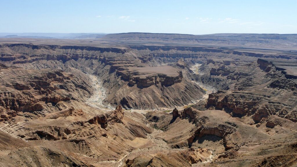
Running 160 kilometers long, 27 kilometers wide, and dropping over 550 meters to the riverbed, many claim Namibia’s Fish River Canyon as the second-largest canyon on earth – though that’s a heated debate. One thing’s for sure though, it’s massive and absolutely wild!
The most popular long-distance trail covers 86 kilometers along the canyon floor, from the rim near Hobas down to the hot springs at Ai-Ais. The route involves wading through river sections, crossing deep sand and clambering over boulder fields with massive walls of rock standing over you on both sides. This is a serious undertaking with serious logistical challenges. For that matter, it can get dangerously hot on the canyon’s floor.
Regardless, it’s one of the great desert walks anywhere on earth, and one of the best African trails if you can handle the heat. The trail is closed in the hottest months, but if you happen to do this one during a “cooler” period, you can treat yourself to a soak in a local hot spring at the end of the trail.
Andringitra Massif, Madagascar – Pic Boby
- Distance: 28 km
- Days: 3-4
- Logistics: Guides mandatory, best mid-April to October
Madagascar sells itself on lemurs and rainforest, and the animated film has only made this side more popular.
For hikers, Madagascar offers a whole lot more.
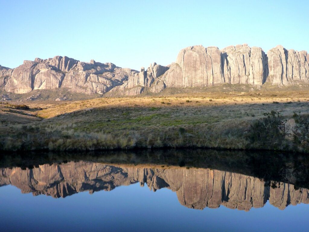
Andringitra is granite. Picture massive domes, slabs and walls rising straight out of the grassland. In the south of the island, including the Tsaranoro face, there’s an 800-meter sheet of rock that pulls big-wall climbers from around the world.
The walk to Pic Boby crosses the massif from the Namoly valley over to Tsaranoro in three or four days. Its Malagasy name is Imarivolanitra, “Close to the Sky”, and at 2,658 meters it’s one of the highest points in Madagascar. You’ll pass through mossy forest and waterfalls, then rice terraces, then a stretch of bare granite plateau the guides call the Alien Corridor.
Just know that nights up there can get cold, close to freezing – which is no one’s first image of this island.
Mount Kenya, Kenya – Point Lenana
- Distance: 65-77 km
- Days: 5-6
- Logistics: KWS permit available online, best January-February or August-September
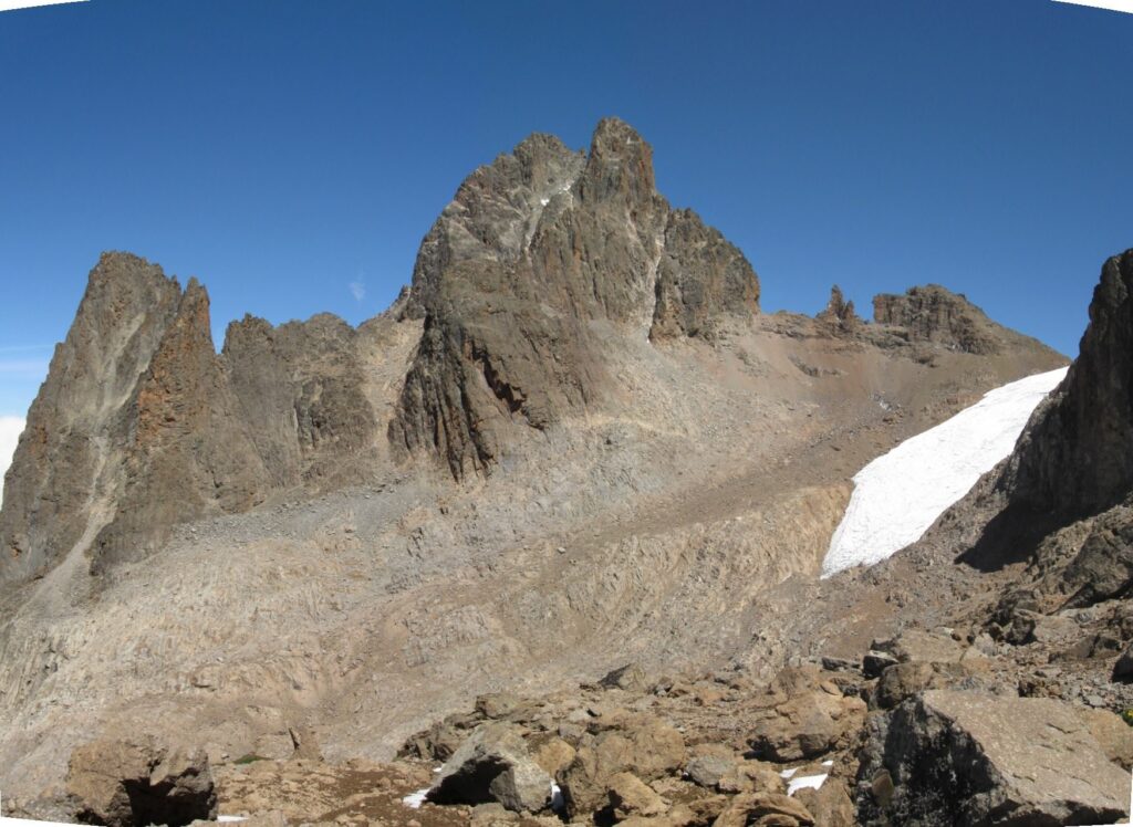
Only three mountains in Africa still hold glaciers – the last of the equatorial ice that covered these summits at the end of the last Ice Age. Kilimanjaro is one, the Rwenzori is another, and this is the third.
Mount Kenya is the second-highest mountain in Africa, but its true summit, Batian (5,199 m), is considerably more difficult to climb than its more famous neighbor. In fact, only about fifty people manage the true summit each year, compared to around 63,000 on Kilimanjaro.
However, there is a more accessible multi-day hike to Point Lenana (4,985 m), which is more accommodating to novice trekkers, requiring no rope and no mountaineering skills to climb. Compared to Kilimanjaro, Point Lenana is still significantly less crowded, and we like to think of it as the perfect hiking destination dupe to Kili.
It’s also a shorter trip (4-5 days vs around 7-8), and has less infrastructure overall. If you’re looking for an accessible mountain to climb in Africa without the overtourism, climb up the Sirimon route for the acclimatization and come down Chogoria past Lake Ellis and Lake Michaelson.
Mount Toubkal, Morocco
- Distance: 30-35 km return
- Days: 2
- Logistics: Licensed Moroccan guide required above Imlil, refuge bunks at 3,207 m
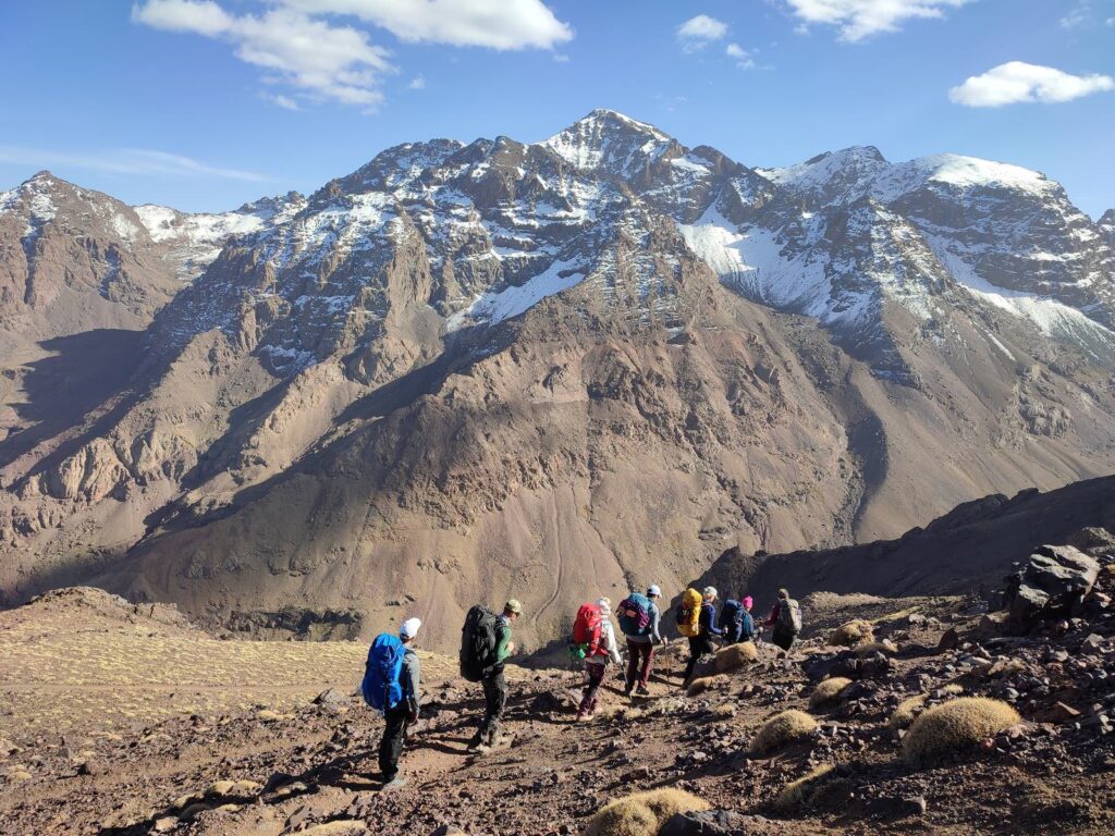
Marrakech is a cheap flight from most of Europe, and the trailhead at Imlil is just 90 minutes from the airport. This makes Toubkal (4,167 m) the most accessible big mountain in Africa while still only seeing a fraction of the foot traffic Kilimanjaro does.
The hike starts in the walnut terraces above Imlil and climbs through Amazigh villages where mules are used to porter supplies. You’ll pass a shrine at Sidi Chamharouch, a whitewashed boulder that’s drawn pilgrims for centuries, then wind your way up to the refuge at around 3,200 meters.
Summit day is a long haul over scree in the dark, and from December to March you’ll need crampons. Toubkal is the cheapest way to climb to real altitude in Africa, though the standard two-day summit trek is only a fraction of what’s on offer here. If you have time, give it five or six days for the Toubkal Circuit, and you’ll have the valleys mostly to yourself.
Otter Trail, South Africa
- Distance: 45 km
- Days: 5
- Logistics: Booked through SANParks 1 year ahead, no one over 65
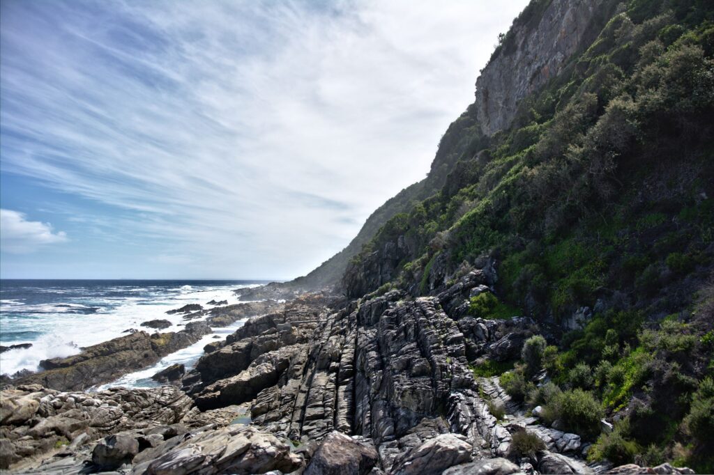
The Otter Trail was South Africa’s first official hiking trail and if you’re in search of African trails on the coast, it may be its best. The trail runs 45 kilometers along the Tsitsikamma shoreline from Storms River Mouth to Nature’s Valley staying in picturesque wooden huts overlooking the Indian Ocean.
For five days you’ll walk between cliffs and white-sand coves along a shoreline only accessible by foot and with no other trekking groups in sight (only 12 people a day are allowed to start).
The daily distances don’t look too demanding on paper, but you’ll get a lot of diversity along those miles. The trail switches between forest, fynbos and wet boulder fields above the surf, and it gives you time to hike at your own pace and enjoy the views.
Ngorongoro Highlands, Tanzania

- Distance: 46 km
- Days: 5
- Logistics: NCAA armed ranger mandatory, donkeys carry the camp, best June-October
If an African safari seen from the inside of a Land Cruiser is not immersive enough for you, then perhaps a trek through the Ngorongoro highlands may be the draw. This is a conservation area rather than a national park, which means Maasai families still live and graze cattle across it, and visitors can hike too.
That said, crossing the highlands on foot is best done with a Maasai guide and an armed ranger, since tusked elephants, Cape buffalo, leopards, and even spotted hyenas roam these slopes. This makes the Ngorongoro Highlands one of the best hikes in Africa to see big wildlife.
The most well-known Ngorongoro Highlands route runs from the crater rim over Olmoti and into Empakaai, a caldera with 300-meter forested walls surrounding a lake where flamingos feed alongside buffalo. From the far rim you’ll get the chance to witness Ol Doinyo Lengai from afar. This is the only volcano on Earth currently erupting natrocarbonatite, a black lava that flows more like water.
Honorable Mention: Tassili n’Ajjer, Algeria
- Distance: 15-20 km per day (approximately 85 km total)
- Days: 5
- Logistics: Accredited Algerian agency required, visa on arrival arranged 15+ days ahead, best October-April
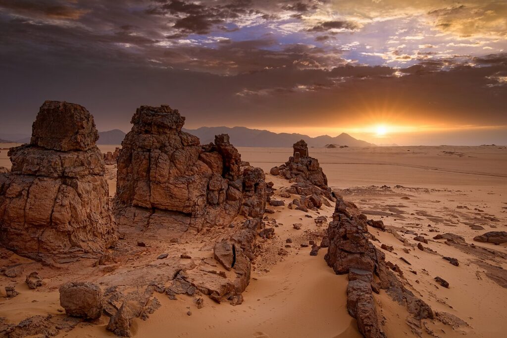
Tassili n’Ajjer is a sandstone plateau of 72,000 square kilometers in southeast Algeria, out where the country runs into Libya, Niger and Mali. UNESCO describes it as a lunar landscape of eroded rock, with formations they call forests of rock.
Around 15,000 paintings and engravings are scattered across it, made over roughly 10,000 years. What’s interesting about these is that the oldest show hippos, giraffes, and herds of cattle from the bygone era when the Sahara was green. As you hike through Tassili n’Ajjer, the paintings guide you through the region’s geographical history, and you can slowly see the cattle give way to horses, and the horses give way to camels.
Treks and hiking routes run three to seven days out of Djanet with Tuareg guides, camping between the towers. The best time to hike is between October and April, but you’ll need to book via an accredited Algerian agency. We ranked this one as “honorable mention” because despite there being hiking trails, getting around via desert 4×4 is more practical. You can connect a few to make for a longer walk, but there are fewer distinct multi-day options here.
The Thing About Kilimanjaro, Tanzania
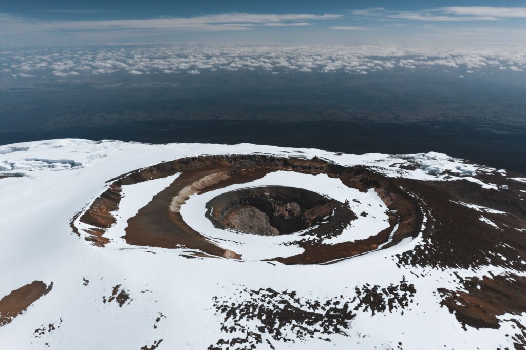
At the beginning of this article, we mentioned Kilimanjaro was severely “overdeveloped“. But what does that actually mean? Recent reports estimate summit numbers are currently reaching 63,000 per year!
To accommodate these numbers, infrastructure on the mountain has expanded significantly to the point where the climb feels a bit more like a packaged tour than a 5,895-meter expedition. For example, Marangu now has huts with bunk beds, and since August 2022 there has been mobile internet on the mountain, and some reporting wifi at the rest camps…
But is it worth it? This author has personally climbed Uhuru at 5,895 meters, and as I mentioned in the intro, I loved the experience. I’d say it’s worth it, but would I recommend it to others, or even do it again, knowing now all the other incredible multi-day hikes and climbs in Africa? Not any longer – the highest point on the continent now feels a little too overdone, and many other African treks on this list do everything it used to offer – sometimes even better.
If you want equatorial glaciers without the queue, the Rwenzori is our starting point – in fact, it’s the trip that kicked off Epic’s hiking tours in Africa!
Check out our trip page for more information.